During the past ice season more than 950 FDDs were accumulated in Peshnoi area which makes it a severe winter. First ice appeared in mid-November although freeze-up took place middle of December. There were almost no thawing periods. Ice cover has reached its maximum by middle of January and remained at that level until maximum ice volume of about 30 cubic kilometers was reached in the first half of February. Break-up started in the end of February. The ice has lasted until end of March with a total season duration of less than 140 days.
Ice Season from Space
Scroll through selection of remote sensing images below to see how ice cover developed through the course of winter.


Ice & Metocean Observations
The following video is a daily time lapse of ice and metocean observations for the whole season
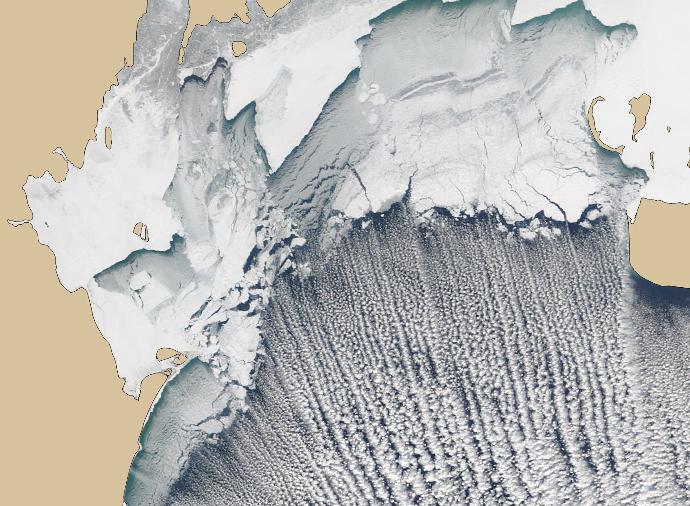
Ice edge in severe winter
Medium resolution optical image in January illustrates extension of ice edge during severe winter.
MORE INFORMATION
Talk to our ice consultants how this information can facilitate your operations.