During the past ice season slightly less than 600 FDDs were accumulated in Peshnoi area which makes it a moderate winter. Ice freeze-up occurred in the first half of December combined with Easterly winds which resulted in almost total complete coverage of Northern Caspian Sea with ice in just a week after first ice. Prolonged cold spell in December resulted in maximum ice extent and volume reaching its peak in the first half of January. Break-up process has started with large scale south-easterly drift and ice cover redistribution in the end of February. Ice has lasted until 4-th week of March with season duration of more than 100 days.
Ice Season from Space
Scroll through selection of remote sensing images below to see how ice cover developed through the course of winter.


Ice & Metocean Observations
The following video is a daily time lapse of ice and metocean observations for the whole season
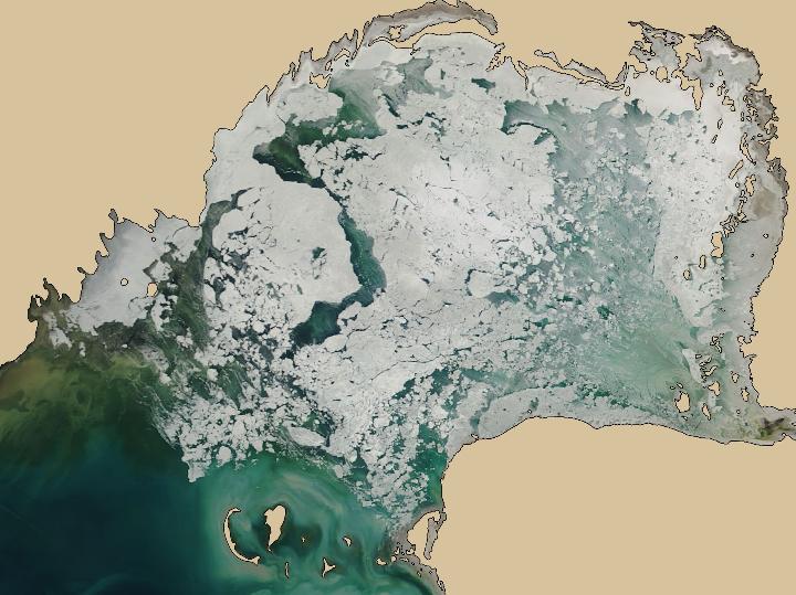
Strong transversal winds
Medium resolution optical image in the beginning of March illustrating strong transversal (NW) wind and its effect on ice conditions.
MORE INFORMATION
Talk to our ice consultants how this information can facilitate your operations.