During the past ice season more than 600 FDDs were accumulated in Peshnoi area which makes it a moderate winter. First ice appeared in the area in middle of November followed by thawing period by end of month. Second freeze-up happened in the beginning of December until middle of January when thawing took place. Maximum ice volume and ice cover was reached in middle of February. Break-up process has started in late February lasted until late March. The season duration was about 130 days.
Ice Season from Space
Scroll through selection of remote sensing images below to see how ice cover developed through the course of winter.


Ice & Metocean Observations
The following video is a daily time lapse of ice and metocean observations for the whole season
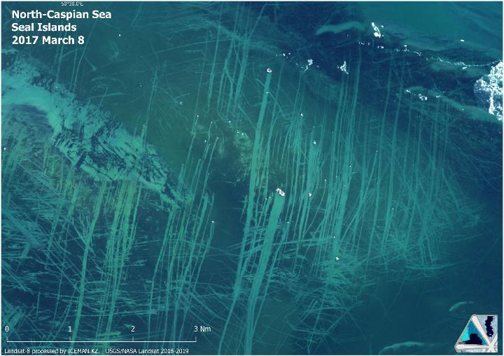
Stamukhi and scours
High resolution optical image Landsat-8 revealed stamukhi and produced ice scours from drift event
MORE INFORMATION
Talk to our ice consultants how this information can facilitate your operations.