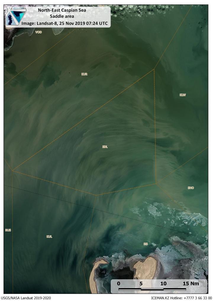
Cloudless Landsat-8 image on 25th November revealed the picture of
sediments transfer by water currents through shallow part of Saddle area
connecting deeper part of central Caspian with Ural furrow. Saddle is
an important area for navigation as nearly all vessels cross it to enter
the northern Caspian waters. With decreasing water level in the sea
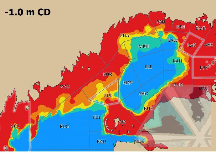
this area attracts a lot of attention as it becomes critically shallow
and might pose a risk of grounding for vessels going through it (see
picture below). In wintertime multiple ice ridges typically observed in
this area make it even more difficult for navigation. This issue is
discussed in our conference paper presented on POAC 2019. Quicklooks of the area in winter seasons are available on our website page.


Accessibility analysis for marine operations in the Northern Caspian for vessels with 3 m draft: Blue – no restriction; Green – Normal operations in shallow waters (restricted cruise speed); Yellow – Slow cruise speed with high risk of grounding; Orange – Slow cruise speed with intermittent grounding to seabed; Red – Inaccessible. Crucial areas for operations in the Northern Caspian (VCC -Volga-Caspian Channel, SDL – Saddle, KAE – Kashagan East, PRV – Prorva) are highlighted.